01
2D aerial mapping
High-overlap drone imagery stitched into a detailed orthomosaic of your property, paddock or site.
- Property overview maps
- Farm and block documentation
- Visual site records
Drone mapping · Christchurch & Canterbury
Clear aerial maps, 3D property models and useful imagery for landowners, farms, agents and small projects.
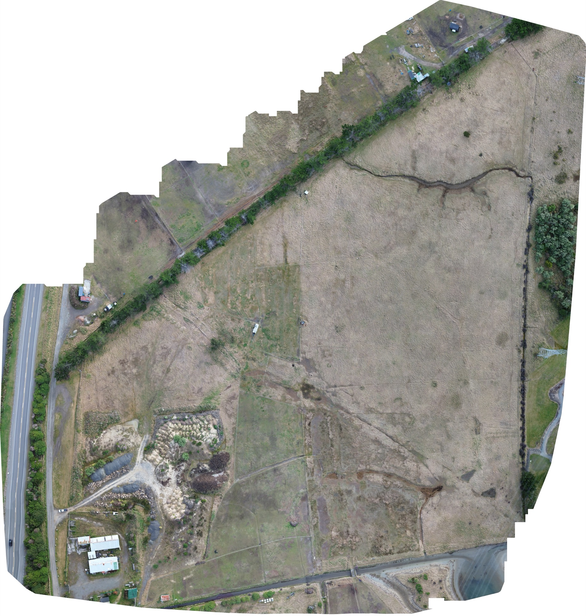
Mapping example: Scruttons Road Farm · DJI Mini 3 + WebODM
Useful outputs. Straightforward jobs. No giant consultancy attached.
Services
Plotbird is built for jobs where a clear view from above is genuinely useful, without turning every project into a full surveying exercise.
High-overlap drone imagery stitched into a detailed orthomosaic of your property, paddock or site.
Photogrammetry captures that turn a real property or structure into a navigable 3D model.
Clean aerial photography for farms, lifestyle blocks and landowners who want to show or document the whole property.
Simple, polished aerial stills and short video clips for listings, websites and property marketing.
Mapping examples
These are existing portfolio projects around Christchurch, using the same mapping workflow Plotbird is built around: planned image capture, photogrammetry processing and useful mapped outputs.
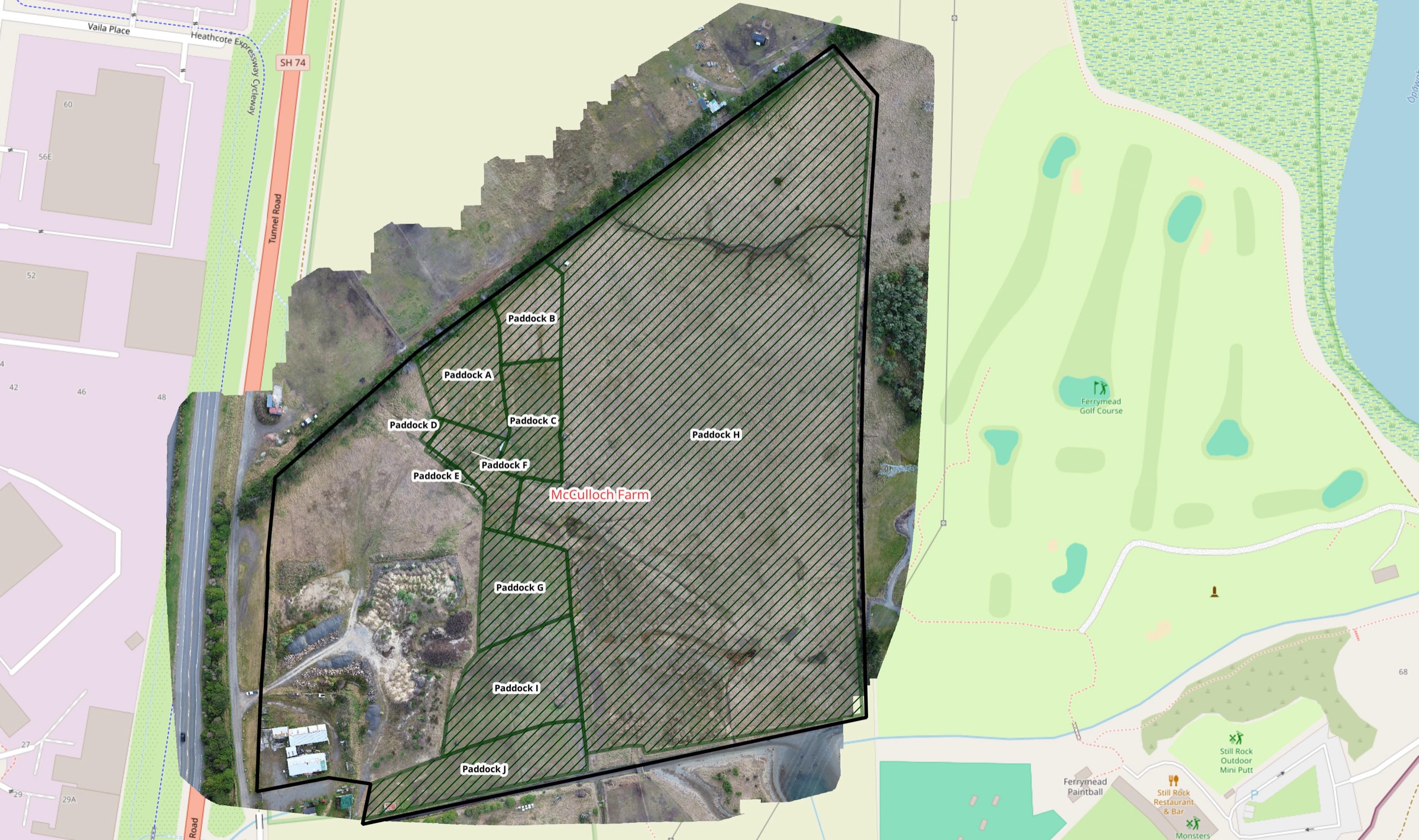
Scruttons Road Farm
A broad-coverage flight was processed into a connected orthomosaic, then paddock boundaries were digitised to create a readable property-wide planning layer.
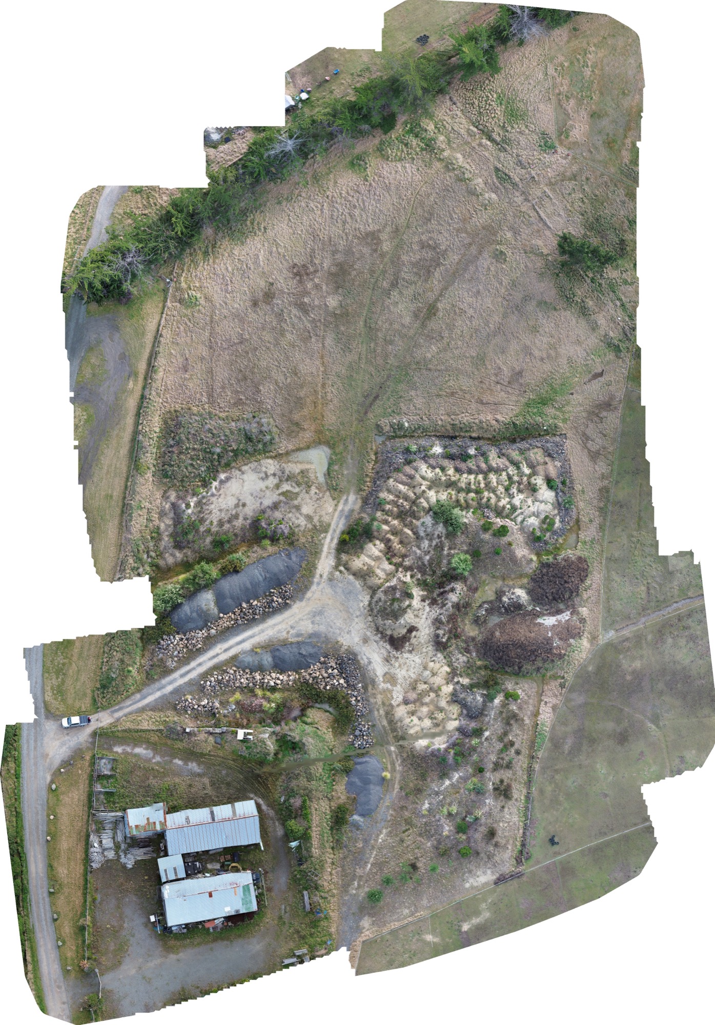
High-detail mapping
2.73 ha · 174 images · 1.1 cm/px
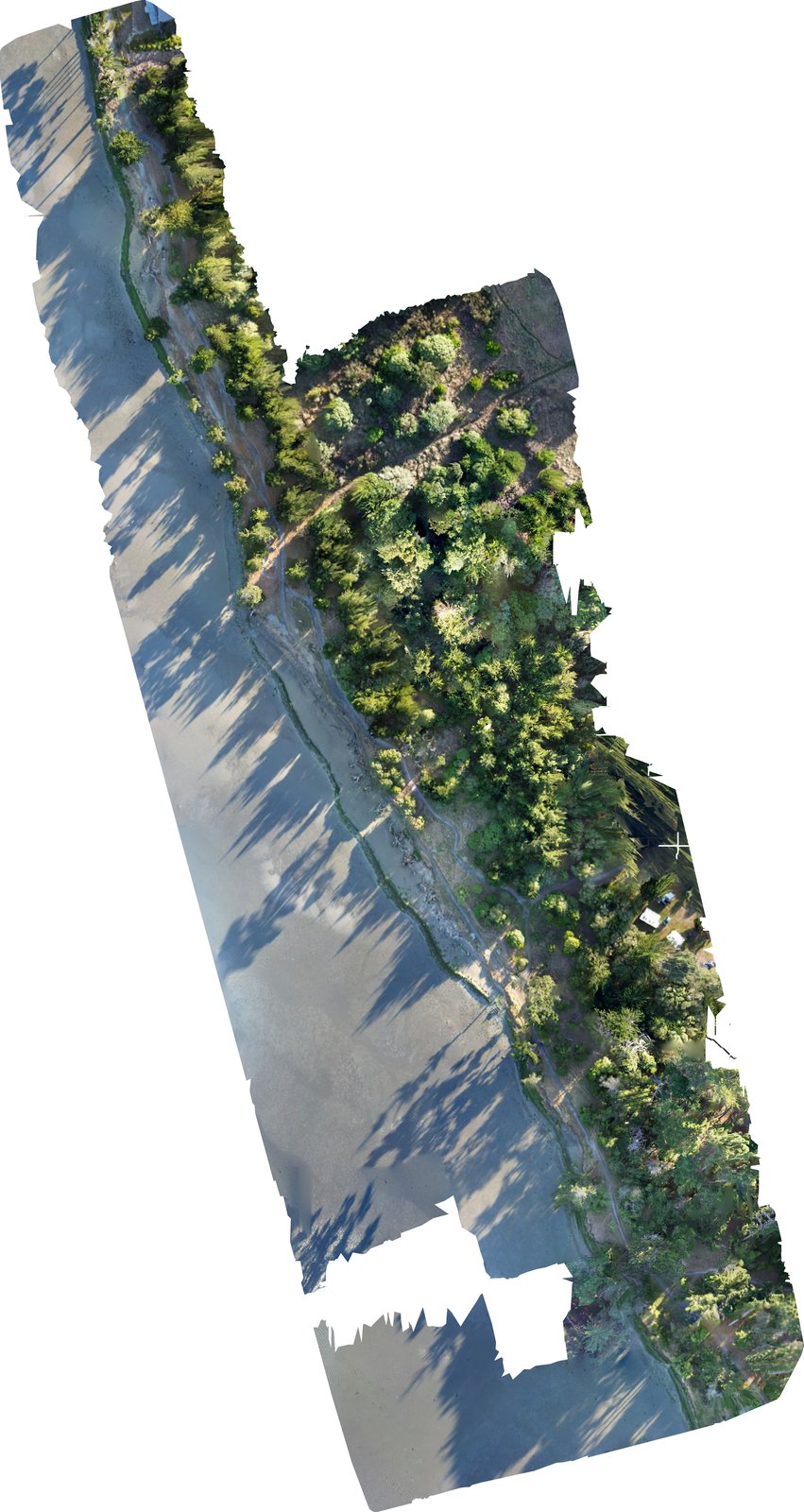
Shoreline mapping
210 images · 1.1 cm/px · 100 m AGL
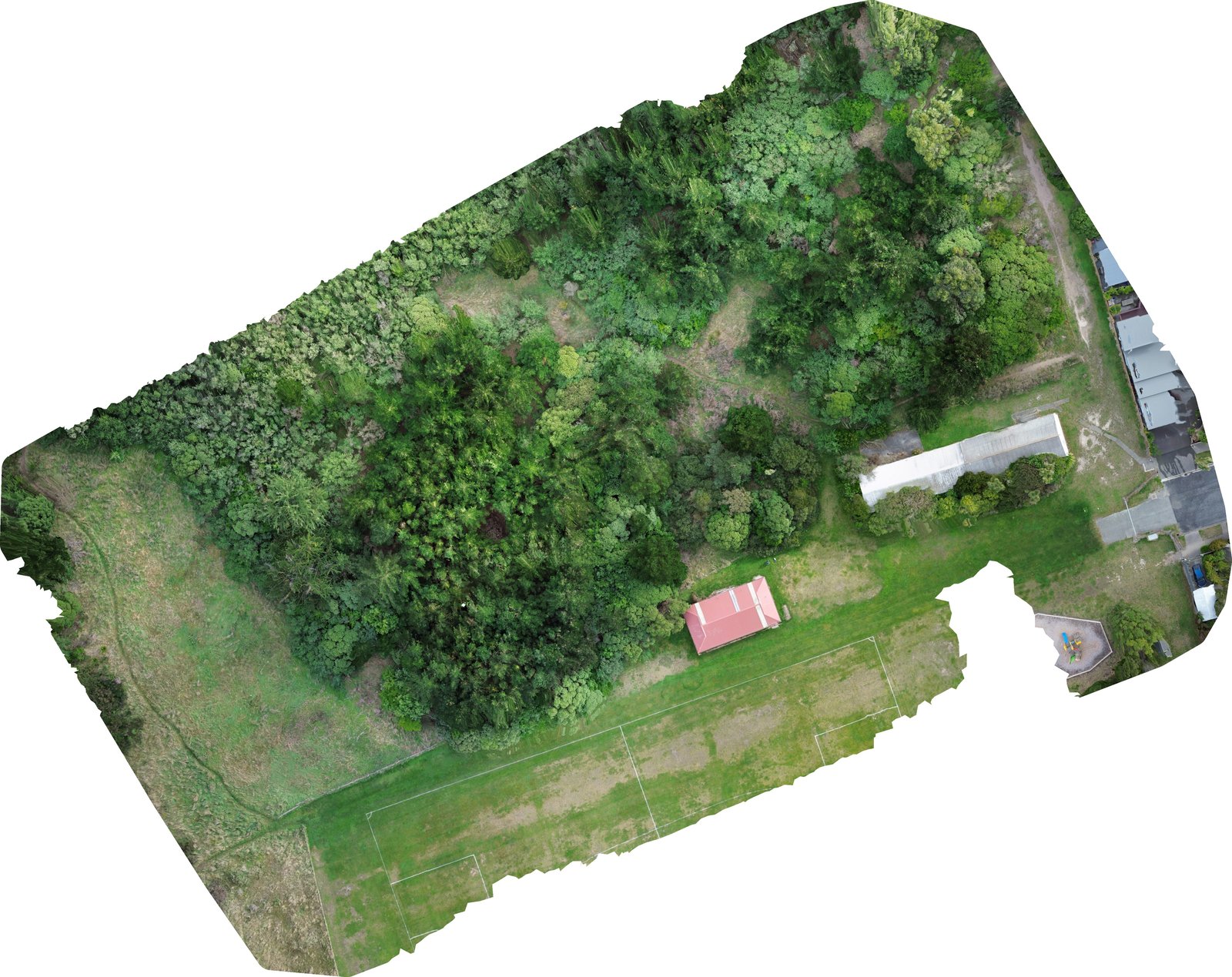
Urban mapping
165 images · 0.9 cm/px · 80 m AGL
Portfolio examples, not represented as licensed cadastral or engineering survey work.
What you get
The point isn’t the drone flight. It’s the map, model, photo set or footage you needed from it.
Files supplied in useful formats, with the job scoped before flying.
Good fit for individual properties and practical one-off projects.
Based in Christchurch and focused on Canterbury work.
If you need a licensed cadastral or engineering survey, Plotbird will say so rather than pretend a drone map is one.
About Plotbird
Plotbird is a Christchurch-based aerial mapping and imagery service for property-sized jobs. The focus is simple: useful outputs, sensible scope, and work that doesn’t need an enterprise sales call attached to it.
That might mean mapping a lifestyle block, building a 3D model of a property, documenting a farm from above, or capturing clean aerial media for a listing.
Common questions
Plotbird is aimed at practical property-sized work. The exact flight and output depend on the site, airspace, weather and what you need to do with the result.
Drone mapping uses a planned set of overlapping aerial photographs to build a detailed, top-down orthomosaic of a property or site. It is useful when one ordinary aerial photo does not provide enough detail or consistency.
Yes. Photogrammetry can turn overlapping images into a 3D representation of buildings, terrain or a defined site. The suitability and level of detail depend on the property and the intended use.
No. Plotbird's mapping is for visual documentation, planning context and imagery. If you need cadastral boundaries, legal measurements or engineering survey accuracy, you need the appropriate licensed professional.
Plotbird is based in Christchurch and focuses on Christchurch and Canterbury. Every job is checked for practical access, airspace requirements, weather and the permissions needed for the proposed flight.
Start with the site
Send the location, roughly what you want captured, and what you need the final output for. That’s usually enough to work out whether Plotbird is a fit.